Mostazal
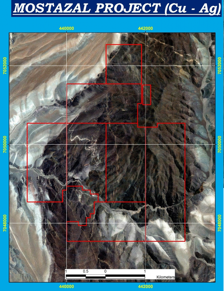
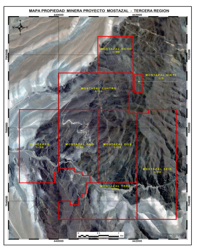
The Mostazal Project is located 80 km NE of the city of Copiapó, 30 km east of Inca de Oro, 42 km south of the copper porphyry El Salvador and 105 km ESE of the port of Chañaral
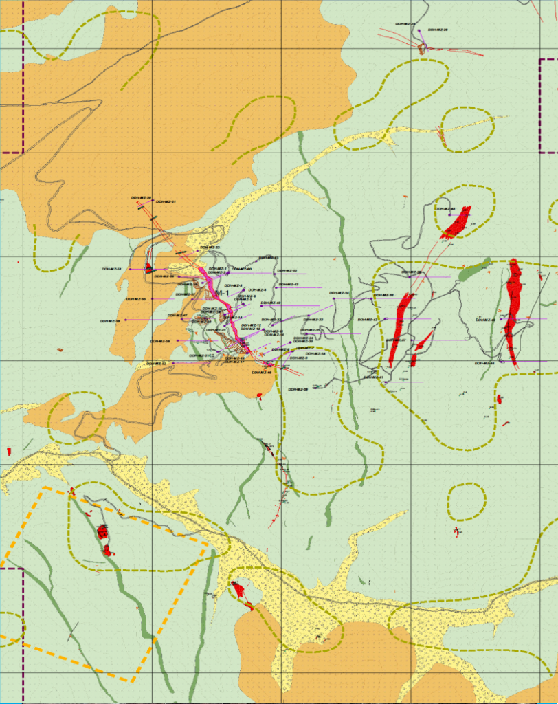
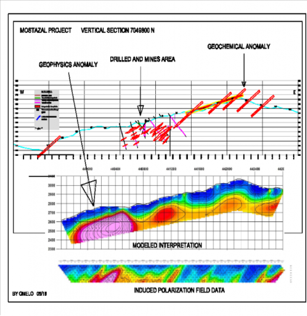
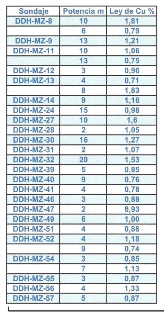
Mostazal is a copper and silver mineralization system strabounded in andesites with mantles of 2 to more than 20 meters of width and extensions in direction of up to 600 meters. There are identified, by means of drilling, 15 lenses in an area of 80 Ha
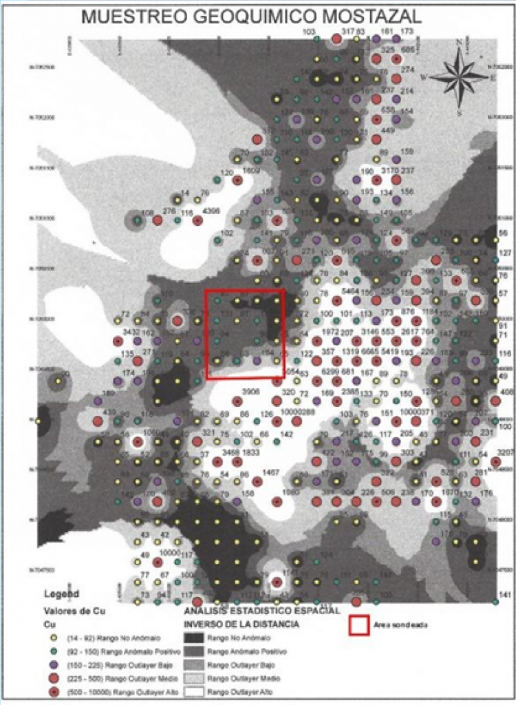
The area of mineralized outcrops and geochemical anomaly of copper is a belt of 3.5 by 2.5 km (800 Ha) that towards the NW is covered by the «Gravas de Atacama Formation»
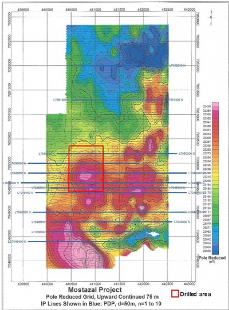
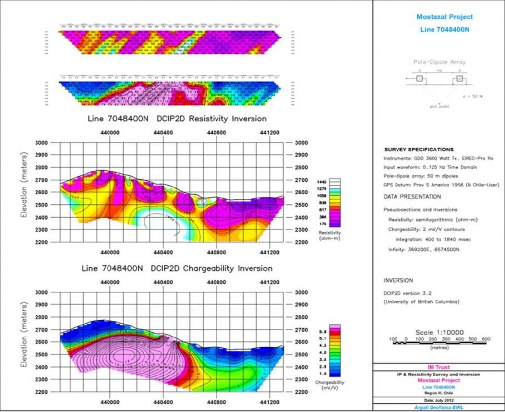
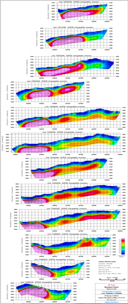
Studies of geology, geochemistry, geophysics (Mag and IP-Res) and 60 DDH drillholes have been conducted with a total of 11,380 m.


EXPECTATIONS
The stratified lenses found so far in Mostazal continue open in direction and in depth. The 11,380 meters of DDH exploration drilling (covering only 10% of the area with evidence of surface copper, and only up to 150 m deep), allow estimating an indicated resource of 10 million tons of 0.95% Cu and 6 g/t Ag, considering lenses of more than 0.5% Cu and more than 2 meters of width.
It is estimated that the potential of the area is greater than 100 million tons of inferred resources because the geochemistry of rocks in 200×200 meters grid indicates a potential area of occurrences of mineralized lenses of 800 Ha (8 Km2) and because the extensive chargeability anomaly in the West sector has not been recognized with drill holes.
Geologically comparable deposits are Mantos Blancos with more than 300 million tons and El Soldado with around 200 million tons
It has been proposed, as a working hypothesis, the possible existence of a copper porphyry in depth, under the main geochemical and magnetism anomaly. The known stratified mineralization would be a distal product of the hydrothermal magmatic system, based on which Mostazal is:
- a) associated with the Domeyko Fault System that immediately passes to the East
- b) in the same longitude and elevation as the El Salvador deposit
- c) with similar lithology and age of formation (belt of the Upper Eocene)
- d) in an environment with evidence of copper mineralization in an area of 5×3 km
